
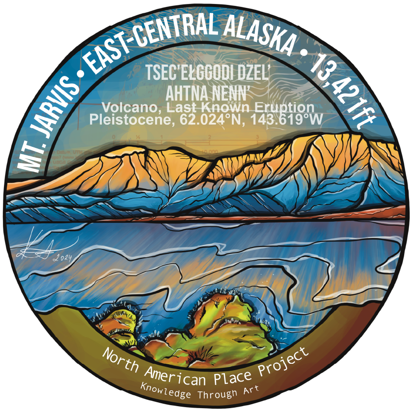
Tsec'eLggodi Dzel’ . Mt. Jarvis
Language: Ahtna
Meaning: He is chipping rocks mountain
Tthech'įhgodi Ddhäl' . Mt. Jarvis
Language: Upper Tanana
Meaning: Rock chipped mountain
Volcanic Province: Wrangell Volcanic Arc
Location: Ahtna Nenn’ / East-Central Alaska, USA - 62.024°N, 143.619°W
Type: Shield Volcano
Age: Estimated to be 1.7 million years old
Last Known Eruption: Pleistocene

Mt. Jarvis
Rock Types:
Major: Andesite / Basaltic Andesite, Basalt / Micro-Basalt, Dacite, Rhyolite
Tectonic Setting:
Intraplate
Continental Crust (>25 km)
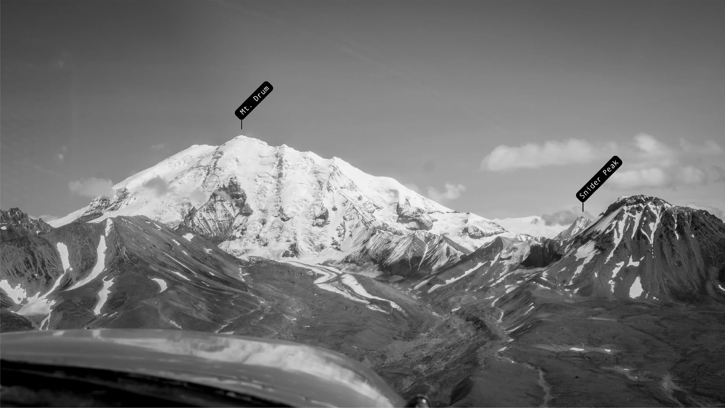
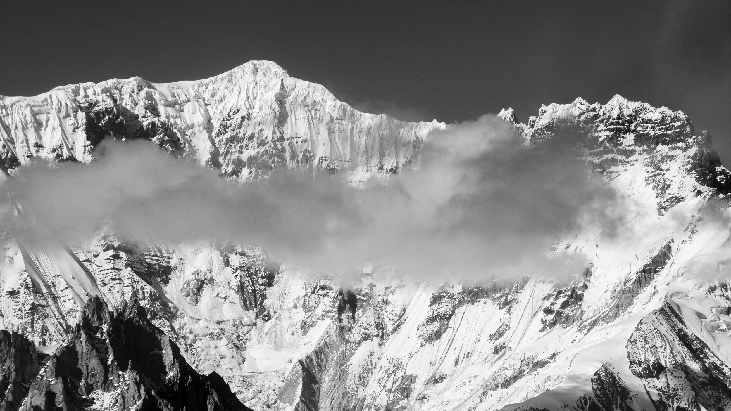
Towering over the Wrangell Mountains in Alaska, Mount Jarvis boasts a fascinating geological history. Like its neighbor, Mount Wrangell, Jarvis is a shield volcano. Imagine a massive, flattened dome – that's the basic structure sculpted by countless slow-moving lava flows over time. However, Mt. Jarvis has eroded during glaciation periods and presents more of a rugged look in the present time.
While the exact age of Mount Jarvis is still being debated, geologists estimate it formed around 1.7 million years ago. The latest explosive activity is believed to have taken place about a million years ago on the north side of the mountain and is defined by a large dacite flow. The mountain's current appearance is largely due to the relentless work of glaciers.
These icy rivers carved away at the once-smooth slopes, exposing the layered volcanic rock beneath.Interestingly, the peak isn't a single summit. Mount Jarvis actually has two prominent peaks, connected by a narrower
Jarvis ridge that is covered in icefields and glaciers. The main summit reaches a height of over 13,400 feet, making it one of Alaska's many "thirteeners" (peaks exceeding 13,000 feet). The second summit, located a few miles to the north, also qualifies as a distinct peak, adding to the mountain's complex structure.
Despite its impressive size and rugged beauty, Mount Jarvis remains a relatively unstudied peak. Its remote location and challenging climbing conditions make it less accessible than other Alaskan giants.

How can you support this project and its continuity?
Learn the cool stuff and share it with your friends. You can download a printable sheet that summarizes this entire series below. Bring it on your drives and flights around the Wrangells!
Buy the art
Display and/or sell it at your business
Collaborate with me on more projects that combine art, history, and science
Acknowledgments
Game McGimsey, retired volcanologist from Alaska Volcano Observatory and one of few scientists to conduct research and expeditions to the Wrangell volcanoes for fact-checking all geology related information shared in the Wrangell Volcanic Field series.Wilson Justin, Ahtna elder and a descendent of the Ahtna Medicine People for sharing his knowledge and giving me a blessing to share Ahtna Indigenous place names with the world. Further thank you to my friend Bryson Corbett for getting me away from the books after long days of research and drawing. And for helping me write the geological history into cohesive and understandable stories. My dear friends Martin, Laura, Becca, and Mike at Copper Valley Air for always getting excited with me, polishing the plane's windows and taking me around these mountains while pushing it on bumpy flights to see these giants up close.Love to all of my friends from the Wrangells and beyond that continue to cheer me on through my journey of exploration. And to everyone who buys my art so I can continue to make more.This project debuted on July 27, 2024, as part of the Stories of Our Landscapes exhibit at the Kennecott Community Hall, an event hosted by the Wrangell Mountain Center in partnership with the National Park Service and the Rasmuson Foundation, with Karolina Zakravska featured as the artist.