
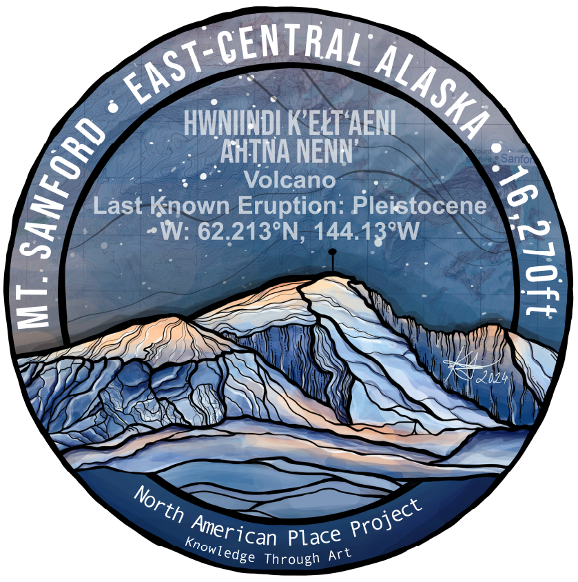
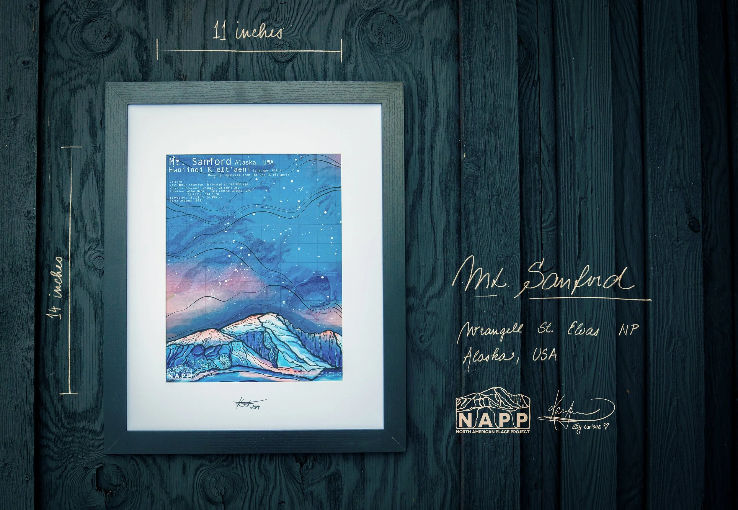
Hwniindi K'eLt'aeni
Language: Ahtna
Meaning: Upstream from The One (K’elt’aeni)
Volcanic Province: Wrangell Volcanic Arc
Location: Ahtna Nenn’ / East-Central Alaska, USA - 62.213°N, 144.13°W
Type: Shield Volcano
Age: Estimated to 900,000 years
Last Known Eruption: Estimated to about 320,000 ago

Mt. Sanford
Rock Types:
Major: Andesite / Basaltic Andesite, Basalt / Rhyolite
Tectonic Setting:
Intraplate
Continental Crust (>25 km)
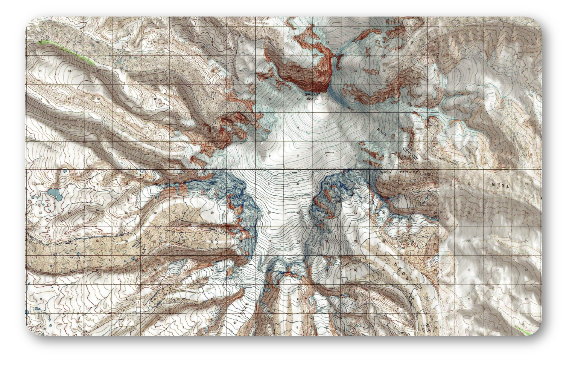
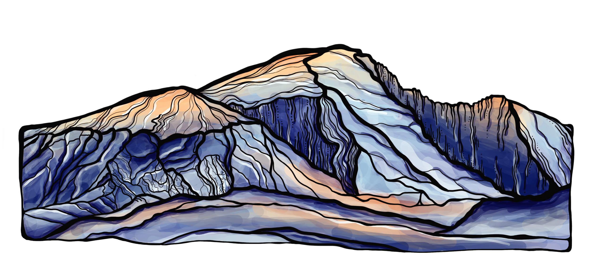
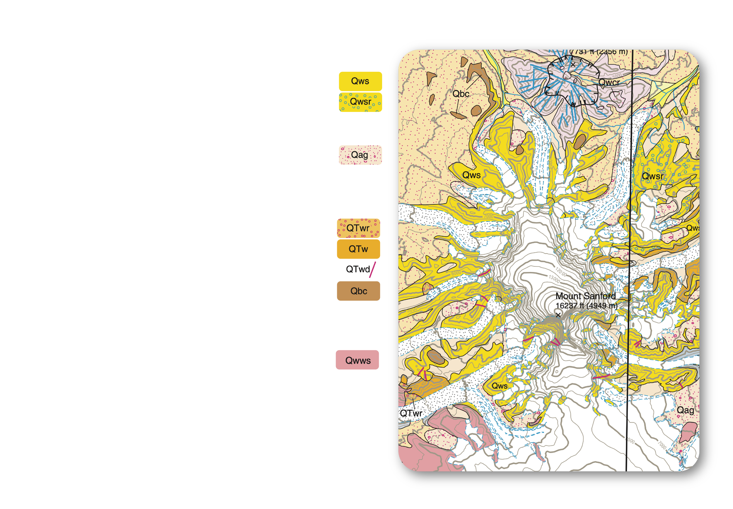
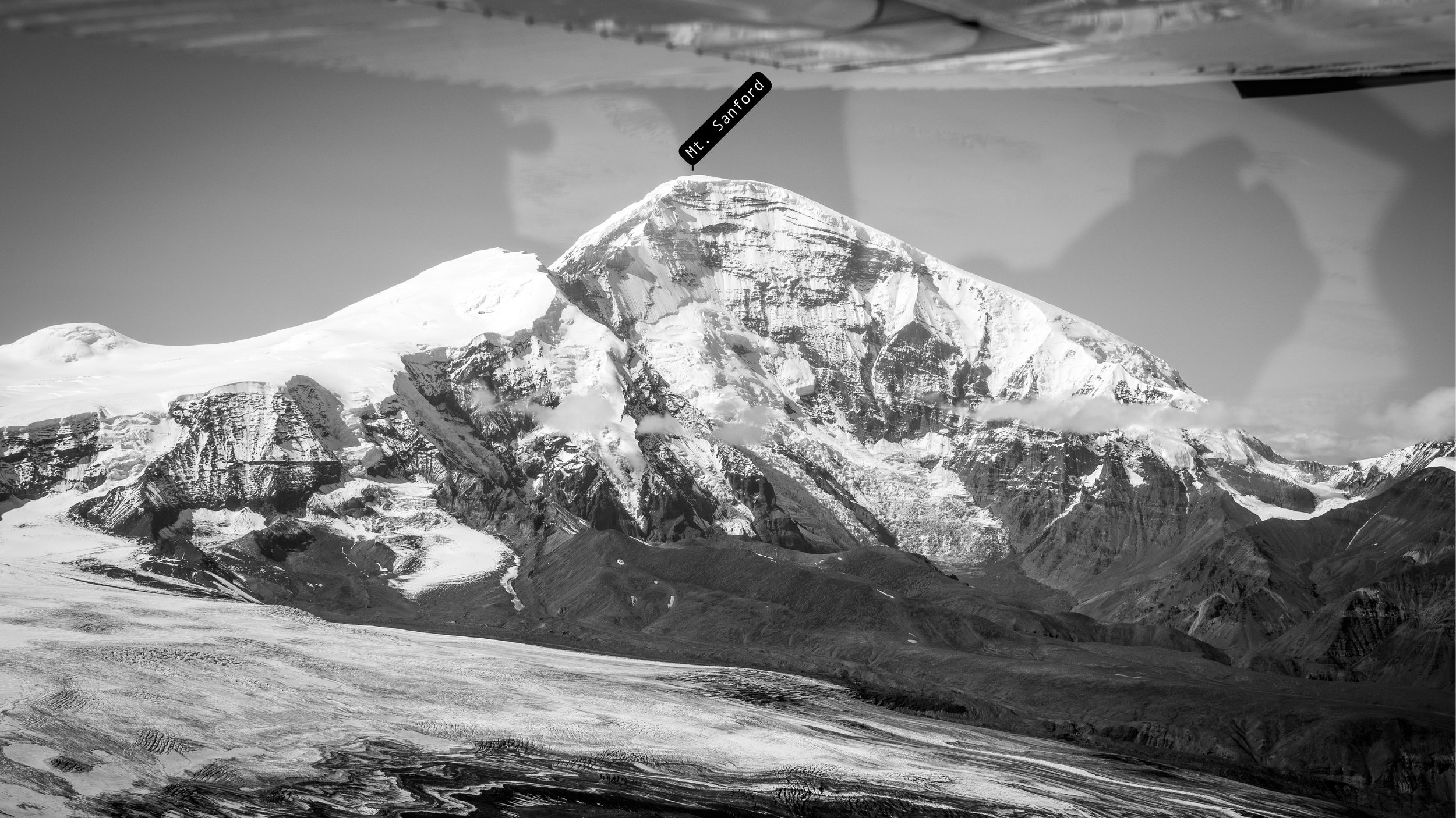
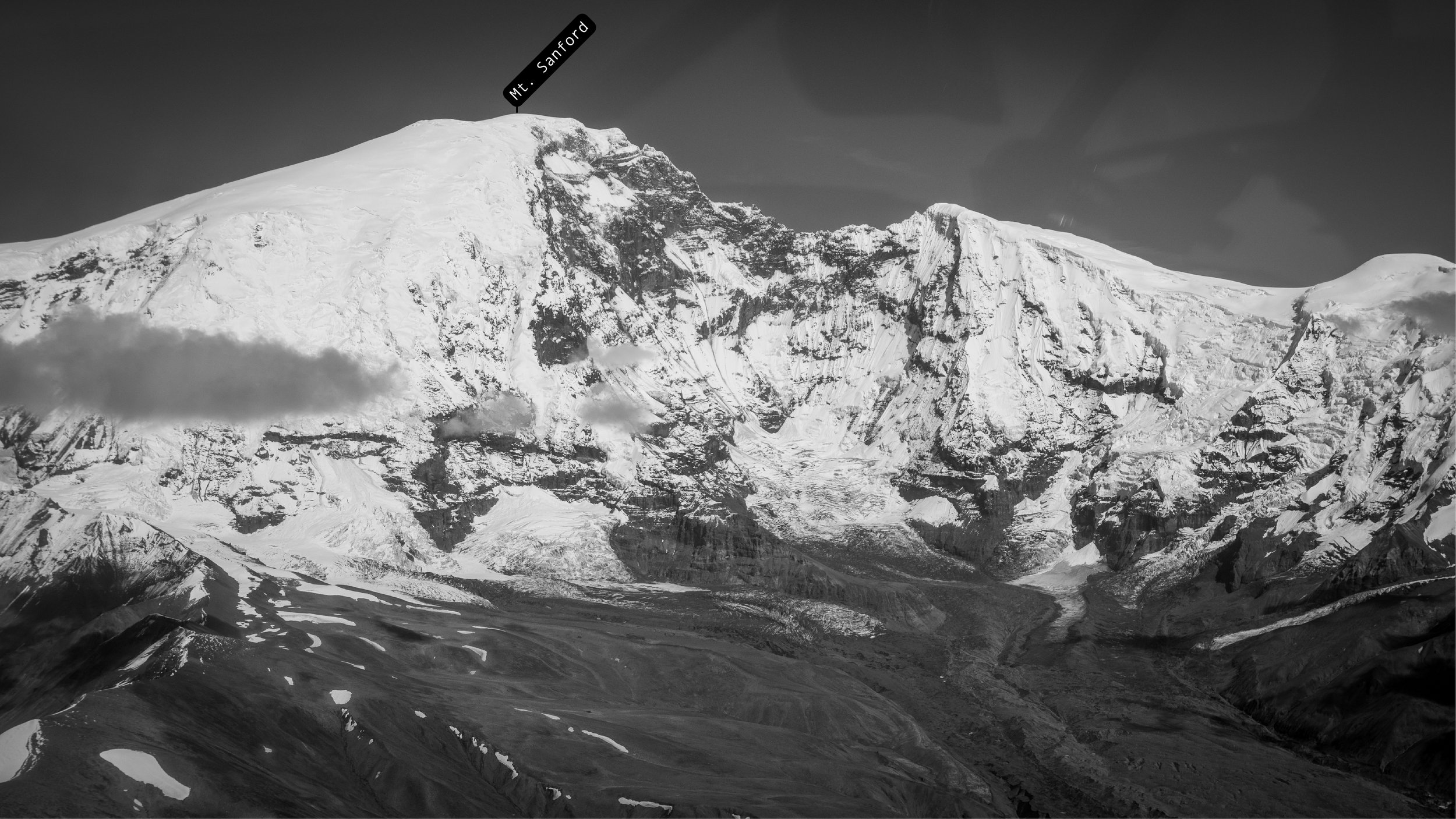
Mount Sanford is a massive, deeply dissected shield volcano capped by a broad, glacier-covered dome. It ranks among the highest Quaternary volcanoes in the United States and towers over the Copper River basin. Its flanks are incised by large cirques carved by glacial erosion, most pronounced on the southwest and southeast sides.
The south face is widely regarded as the steepest major mountain face in North America, rising approximately 8,000 feet in one mile. Despite its heavy ice cover, geological evidence suggests the upper portion of the volcano is relatively young—possibly Holocene in age—and was built atop older, coalescing andesitic shield volcanoes. These ancestral volcanic centers, located to the south, northwest, and north-northwest of the modern summit, began forming roughly 900,000 years ago.
Geologic records document a major mid-Pleistocene rhyolitic lava flow, dating to approximately 600,000–500,000 years ago, that erupted from a vent on the northeast flank and traveled more than 18 kilometers. This single lava flow is locally more than 1,000 feet thick. The most recent radiometrically dated volcanic activity occurred about 320,000 years ago, when basaltic lava flows erupted from a rift zone along the northeast flank.
Most of Mount Sanford is covered by perennial icefields above 8,000 feet. These icefields feed multiple alpine glaciers, including Sanford Glacier, which originates in the large cirque at the base of the south face. This glacier transports vast amounts of debris generated by constant rockfall and erosion of the steep southern wall.
HOW CAN YOU SUPPORT THIS PROJECT AND ITS CONTINUITY?
Learn the cool stuff and share it with your friends. You can download a printable sheet that summarizes this entire series below. Bring it on your drives and flights around the Wrangells!
Buy the art
Display and/or sell it at your business
Collaborate with me on more projects that combine art, history, and science


Acknowledgments
Game McGimsey, retired volcanologist from Alaska Volcano Observatory and one of few scientists to conduct research and expeditions to the Wrangell volcanoes for fact-checking all geology related information shared in the Wrangell Volcanic Field series.Wilson Justin, Ahtna elder and a descendent of the Ahtna Medicine People for sharing his knowledge and giving me a blessing to share Ahtna Indigenous place names with the world. Further thank you to my friend Bryson Corbett for getting me away from the books after long days of research and drawing. And for helping me write the geological history into cohesive and understandable stories. My dear friends Martin, Laura, Becca, and Mike at Copper Valley Air for always getting excited with me, polishing the plane's windows and taking me around these mountains while pushing it on bumpy flights to see these giants up close.Love to all of my friends from the Wrangells and beyond that continue to cheer me on through my journey of exploration. And to everyone who buys my art so I can continue to make more.This project debuted on July 27, 2024, as part of the Stories of Our Landscapes exhibit at the Kennecott Community Hall, an event hosted by the Wrangell Mountain Center in partnership with the National Park Service and the Rasmuson Foundation, with Karolina Zakravska featured as the artist.